Charleston Aftermath: Hurricane Matthew Photos and HD Aerial Videos
- Photo Gallery: Charleston, SC Snowmageddon / Snowpocalypse 2018
- Charleston Aftermath: Hurricane Matthew Photos and HD Aerial Videos
- Fort Sumter
- Aiken-Rhett House – Charleston, South Carolina
- Drayton Hall – Charleston, South Carolina
- Nathaniel Russell House – Charleston, South Carolina
- Calhoun Mansion – Charleston, South Carolina
First off, here’s the video we shot with my drone that I impulsively bought at the Apple Store in Greenville earlier today. It shows the Harleston Village around Beaufain, Smith, Rutledge, Coming etc…
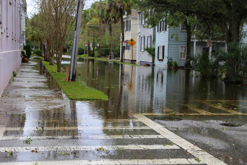
All of the pictures were shot around 5-6pm on Saturday 10/8.
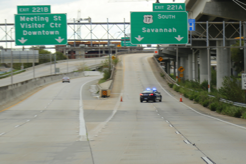
Lots of roads closed to The Peninsula

Blurry but the point remains: Family Dollar used ALL of the sand bags
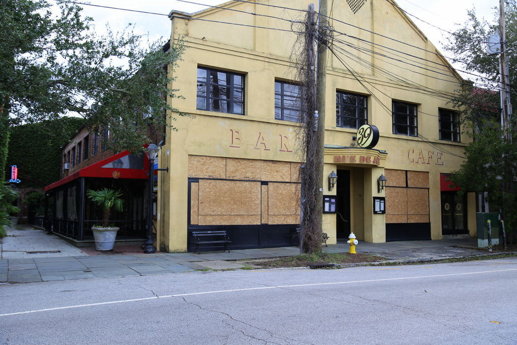
A boarded up 39 Rue de Jean
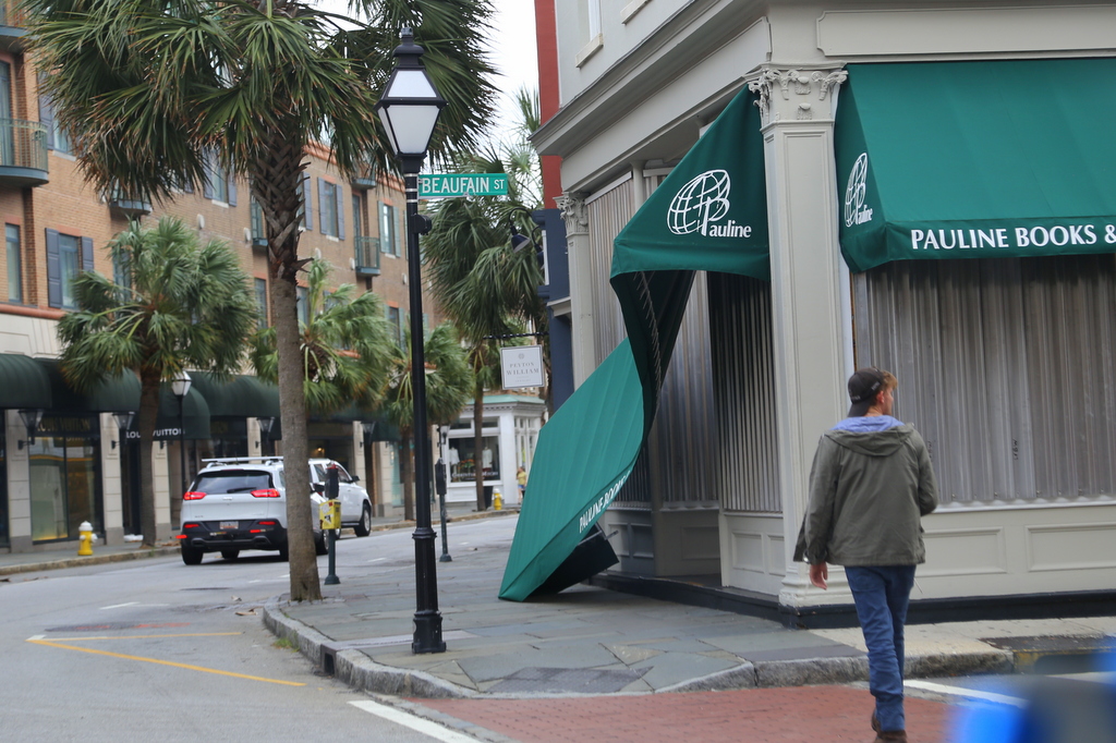
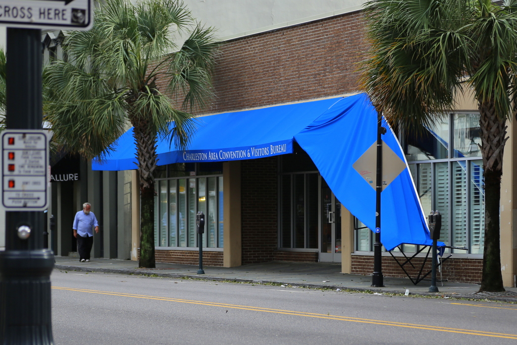
Awnings, a common victim of Matthew
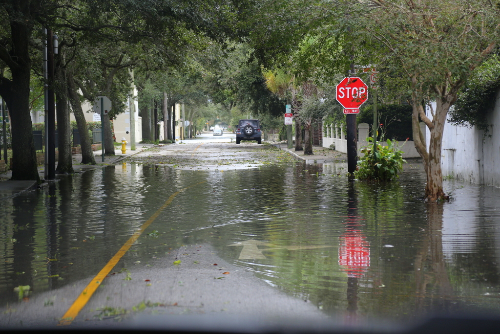
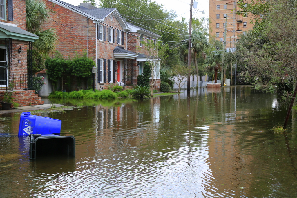
We found most streets to be a bit of an (expected) mess…
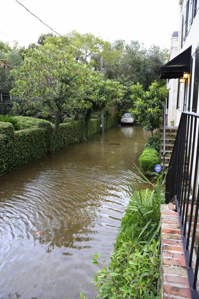
Still plenty of water in this driveway

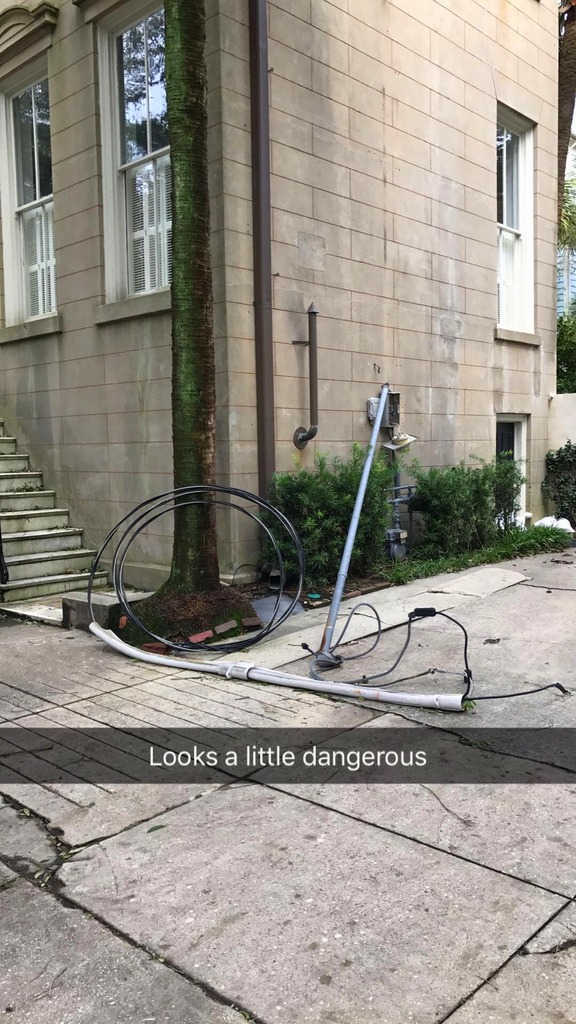
This looks fun to clean up
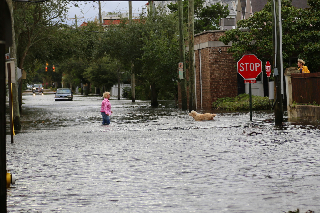
Corner of Smith & Beaufain, lady is having trouble catching her dog
Wentworth, between Rutledge & Ashley
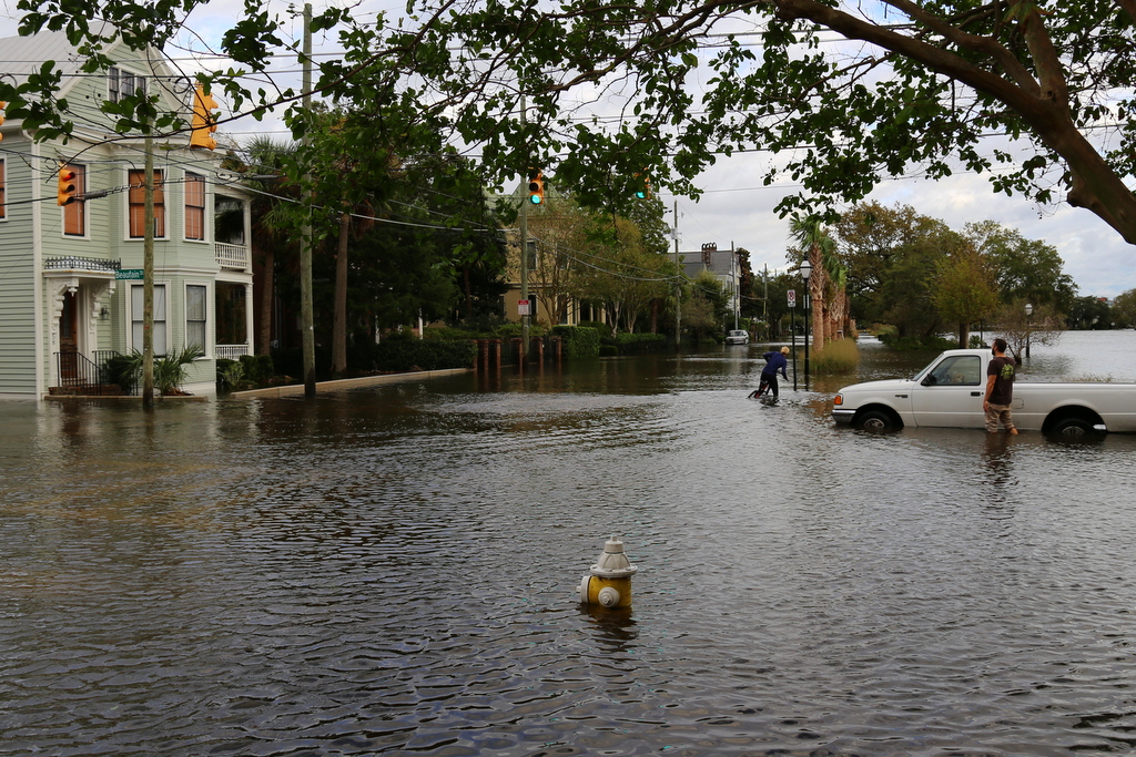
Dude man misjudged the depth and drove his car straight in
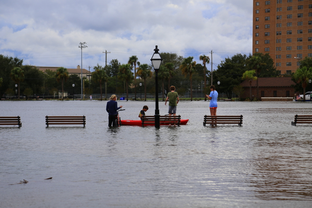
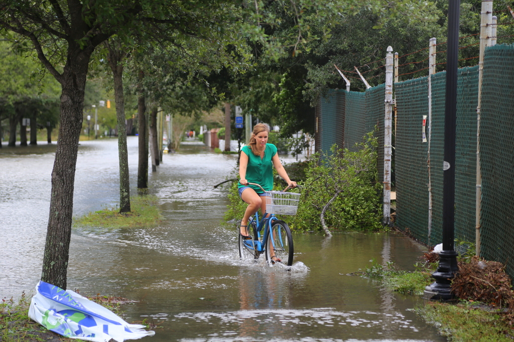
Kayak: the preferred method of transportation
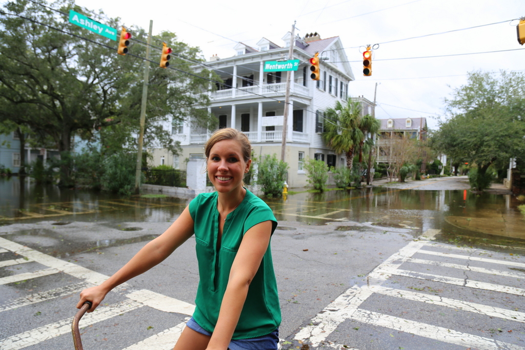
Corner of Wentworth & Ashley
Looking down Gadsden from Beaufain. In the distance, looks like someone is missing a sofa.